Do you wish you had a crystal ball that could tell you what the climate will be next year when you plan your garden? So do many other gardeners (and climatologists). But while there is no magic answer, we do know that in many parts of the United States and other countries, year-to-year climate variability is strongly dominated by what is going on in the eastern tropical Pacific Ocean. This is through a phenomenon called “El Niño Southern Oscillation” or ENSO for short.
What is ENSO and how does it affect climate?
ENSO has three phases—a cold phase with unusually cold water in the equatorial Eastern Pacific Ocean (EPO) called “La Niña”, a warm phase with unusually warm water in the EPO, and the neutral phase that occurs between the two extreme phases. The ocean see-saws back and forth between the two opposite phases on a semi-regular pattern that usually lasts between two and five years from one El Niño to the next. Sometimes you can have two La Niña years (or even three) back-to-back (the end of 2021 is expected to be a second La Niña in a row), but you almost never have two consecutive years of El Niño.
In many parts of the world, the phase of the ENSO is highly correlated with the climate. Scientists can use that relationship to predict what the climate might be like in the coming months. That is helpful for gardeners who need to know what to expect both next season and next year for planning purposes. Not all parts of the world have a climate that is well correlated with ENSO, however, and so folks in those areas will have to depend on other methods to look ahead to next growing season. Winter has the best correlation between ENSO phase and climate, while summer is much less predictable. And every El Niño and La Niña is distinct, leading to variations from the statistical pattern we expect.
How does the temperature of the tropical Pacific Ocean affect climate in other parts of the world?
You might think that unusually warm or cold water in the equatorial Pacific Ocean would not have much impact in other parts of the world because of the distances involved, but it does. Since the atmosphere flows like a river, putting unusually warm water (El Niño) into the EPO acts like putting a rock into a stream. The flow of water (or air) shifts around the rock, changing the pattern of atmospheric winds that blow weather systems around. When we are in a warm El Niño phase, the storm track shifts south and covers the southern US, leaving the northern US warmer and drier than usual. When I lived in Wisconsin, we noted that lake ice cover in El Niño winters did not last as long as other years, which made ice fishermen like my dad unhappy. La Niña shifts the storm track in the opposite direction. Because of that, La Niña winters are colder and wetter than average in the northern US since the storm track shifts north into the Ohio River Valley and sometimes even farther. This leads to cold, damp winters in the northern US. Similar correlations, called teleconnections, are seen statistically in climate records at many places on earth.
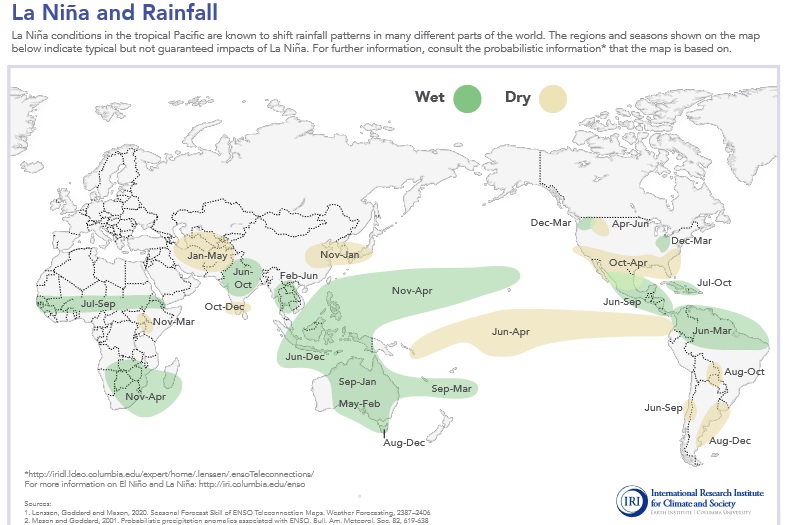
If we know what the phase of ENSO is likely to be, that tells us what climate conditions are expected in areas where there is a teleconnection between the EPO and that region. While every El Niño and La Niña is unique, statistically they do provide guidance on what to expect in that region, and most years they are correct, although once in a while a wildcard like a Sudden Stratospheric Warming will occur and give us an occasional busted forecast, as it did in February 2021.

What do we expect this year?
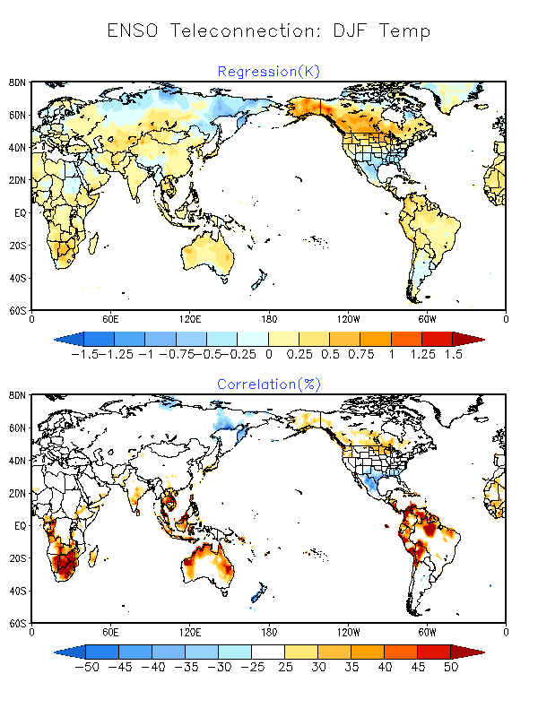
Right now, we are in neutral conditions following last winter’s La Niña, but we are headed back towards another La Niña in the next couple of months (almost an 80% chance in the November through January period). That phase should last for most of the winter but is expected to return to neutral by spring. After that, it is too far out to make a believable prediction. The Global ENSO Temperature and Precipitation Linear Regressions website provides global correlations between the ENSO phase and what kind of temperature and precipitation anomalies to expect. In it, each three-month period shows the relationship between the temperature anomaly of the EPO and other parts of the world (regression) and how strong that relationship is (correlation).
In the map below for December-February (DJF) temperature, it shows that if the EPO is unusually warm (+) in an El Niño, then the northern part of the US will also be unusually warm (+) while the southern states are cooler than normal (-). The storm track over the southern US in an El Niño year brings rain and clouds to that region, keeping conditions wet and cool due to lack of sunshine. A La Niña year is just the opposite. The strong correlation in both southern and northern states shows that it happens most of the time, but in areas with little correlation, you can’t use ENSO reliably to predict seasonal conditions. If you have a hard time interpreting these maps, the website has a tab that explains it in more detail.
The bottom line
For this coming winter, I expect warmer and drier conditions than usual in the southern tier of US states as the storm track shifts north. That means more overwintering of insect pests and diseases; an early start to the growing season is also likely. The northern US is expected to see colder and wetter conditions than usual, which means a later start to the 2022 growing season but less chance of drought next year, although fungal diseases could be bad if the damp conditions continue into spring and summer. Western Europe could see warmer conditions than usual but the correlation is weak so that is not a strong forecast. Australia is likely to be colder than normal, with a fairly high probability because the correlations are high, at least near the coasts. This should last until spring, when the La Niña ends, and we swing back into neutral conditions when other climate factors become more important. In the Southeast, the summer after a La Niña ends is also a hot and dry summer due to the lack of recharging rain over the winter, so I think we have the potential for drought in the Southeast next summer.
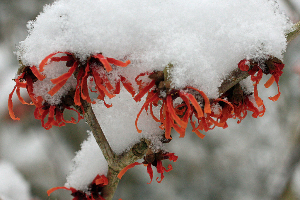
What are the flowers covered in snow?
Thanks for asking! That is witch hazel, an early-flowering shrub. I have updated the caption with more information.