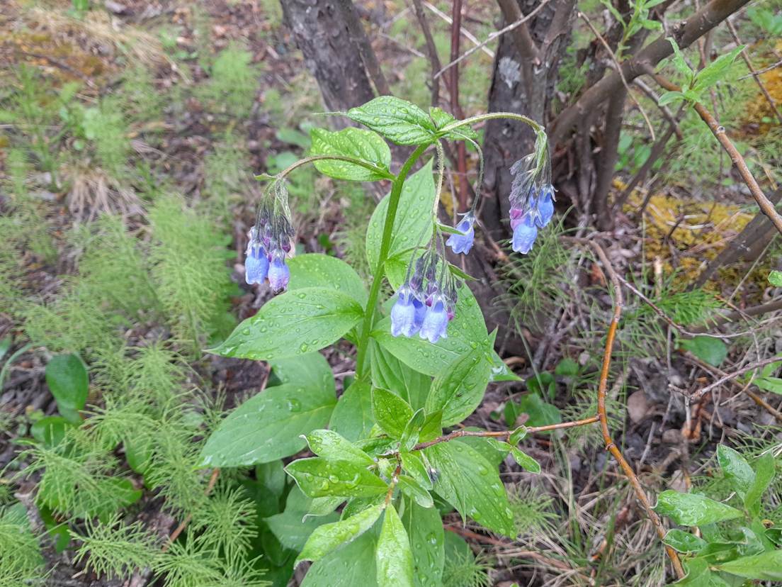
It’s been a couple of months since my last blog post, and a lot has been happening in weather and climate since then. This post will bring you up to date on the extreme weather and climate conditions we have seen since May and discuss what we can expect in the coming months. I missed last month because I was on a cruise-tour in Alaska following my retirement from the University of Georgia and was enjoying looking out the balcony window. I also enjoyed temperatures in the 50s and 60s compared to the 90s that was waiting for me back home in Georgia! I saw a lot of beautiful wildflowers as well as wildlife like humpbacks, orcas, Dall sheep, and grizzly bears plus many different bird species. I hope that wherever you are, you have been enjoying your local conditions and watching your garden grow! If you have time, it would be great to see some photos on the GP Facebook page.
The growing El Niño
In my last post in late May, we were still officially in neutral status but were expecting to hear a declaration of an official El Niño starting at any moment. That declaration came on June 11, when NOAA’s Climate Prediction Center officially noted that an El Niño episode had begun. In April we discussed the prediction that this might be one of the stronger El Niños on record and on the media’s discussion of the potential for a “super El Niño”. Now the El Niño (EN) has formed and is intensifying rapidly, and the forecasts for a record-setting EN are still there. In fact, there is an 81% chance of a very strong El Niño by the October through December period at the end of 2026, with a 97% chance that it will last through early spring. The last time we had a very strong El Niño was in 2015.
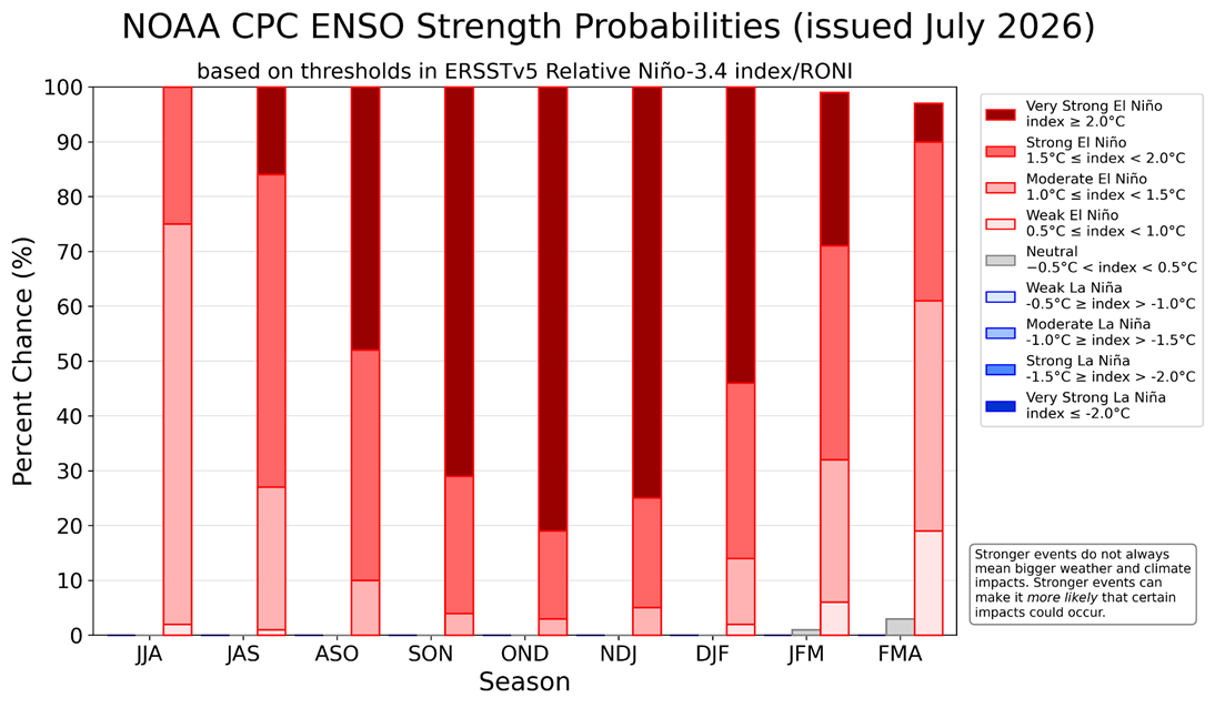
We have previously discussed the impacts of an El Niño on U. S. and global climate here and here. You can also read more about its global impacts here and access many additional resources from NOAA’s Pacific Marine Environmental Lab. It is important to keep in mind that a very strong EN does not necessarily mean that impacts will be more extreme but that they will be more likely. That means we have more confidence than usual in the seasonal predictions that have been made for the rest of this year. Those predictions include warmer and drier conditions than usual across the northern half of the United States and cooler, wetter conditions in southern regions where the jet stream associated with EN will bring multiple storms across the area.
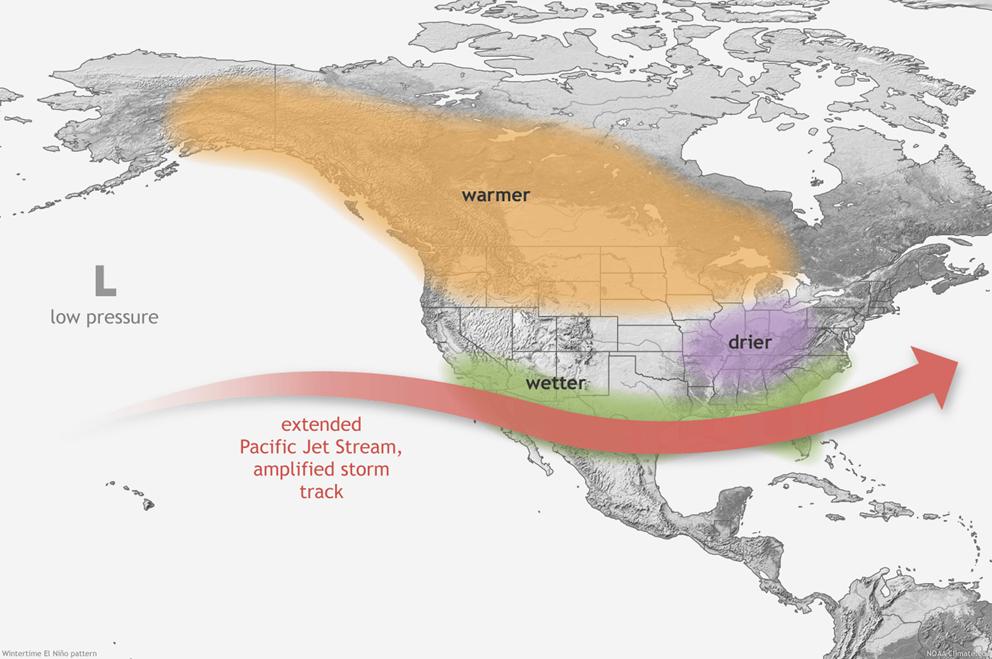
Whether or not the South gets more snow is not certain, since snow depends on having cold air and moisture present in a location at the same time, which does not always happen even in an EN winter. Areas on the northern edge of the rain band like Tennessee and western North Carolina are more likely to experience snow than areas farther to the south. Cool conditions in the South are due more to cloudy and rainy conditions than to big cold outbreaks and could be reduced by the trends to warmer conditions we are seeing across the globe from greenhouse warming.
Drought conditions
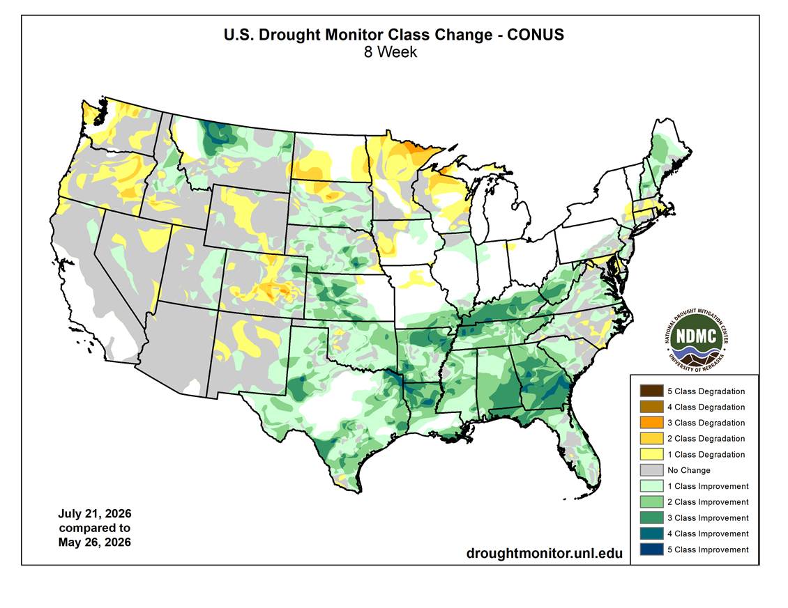
When I wrote my last blog post, exceptional drought was affecting parts of the Southeast and drought covered many parts of the western United States, too. Since late May, rain has returned to the Southeastern US and has significantly reduced the drought there, but drought conditions remain in the western half of the country and have gotten worse in many regions, including the Northern Plains, the Pacific Northwest, and the Front Range of the Rockies. The Great Basin region has also continued to stay dry.
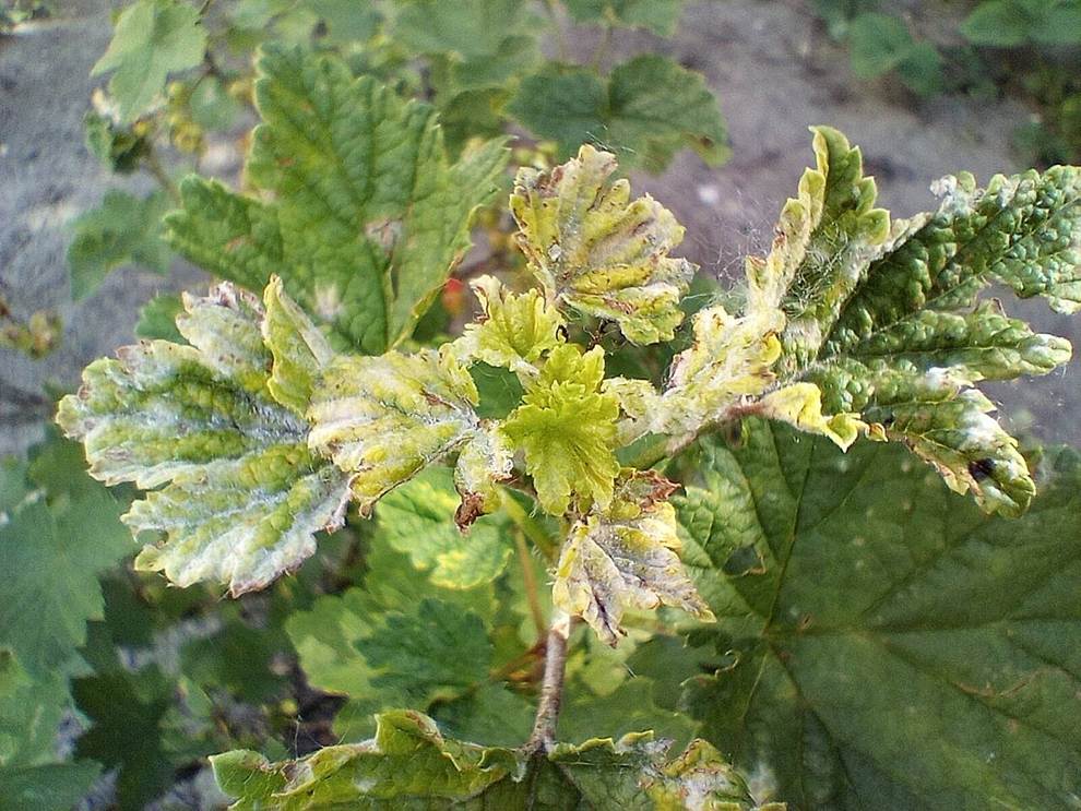
In the Southeast, the recent wet conditions have caused significant issues with fungal diseases on commodity crops and in gardens and the frequent storms have made it difficult to apply herbicides and other pesticides on a timely basis. In the drought-affected areas of the country, gardeners are having to work hard to keep their gardens irrigated and some crops are being affected by the lack of moisture. In some areas, very dry conditions were followed by floods, leading to problems on both ends of the spectrum for farmers and gardeners.
Heat waves and forest fires
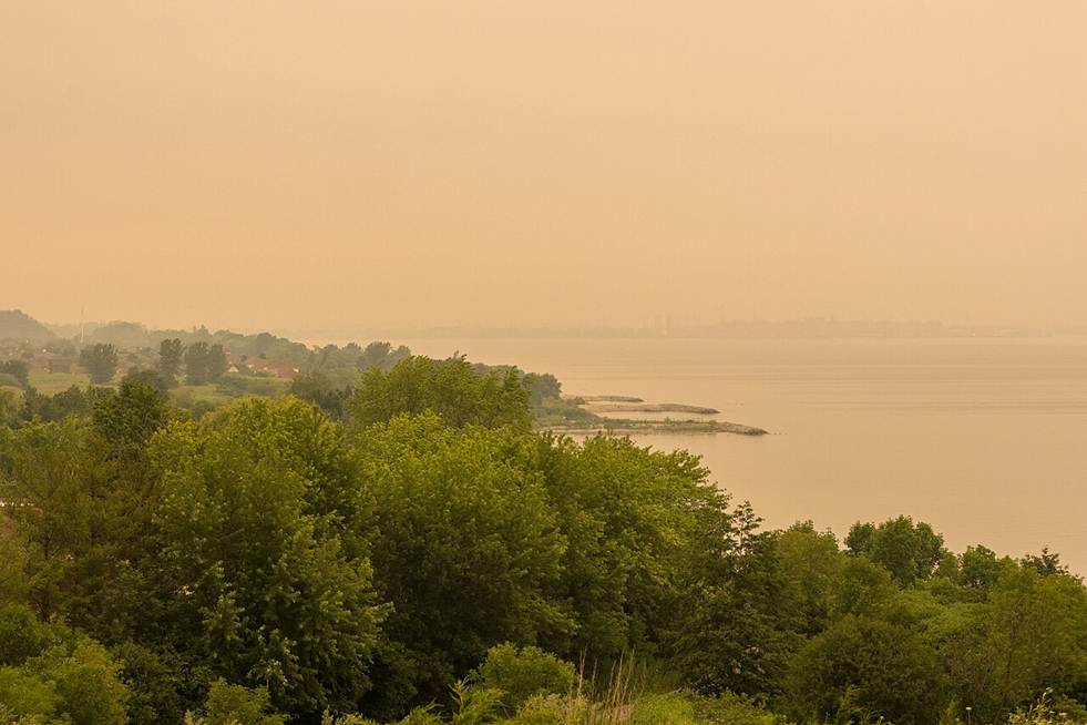
Along with the drought conditions, many areas of the world are experiencing severe heat waves and wildfires, including Canada, Europe, and South America. In the United States many northern states have experienced poor air quality due to smoke and particulate matter blowing into the region and this has affected both gardens and gardeners. This has resulted in impacts similar to those that were described in a 2023 post here. The extreme heat has caused problems for people working outside, including gardeners and agricultural workers, as well as those who live in areas that do not commonly have air conditioning.
Tropical Storm Bertha and the revised hurricane forecast
So far, the early part of the Atlantic hurricane season has been quiet, with just two short-lived storms affecting the United State, including Tropical Storm Bertha just last week. The rainfall from the two storms has helped reduce the drought in areas along the paths of the storms but has not much other impact. The rapid rise of El Niño conditions has led hurricane forecasters at Colorado State, NOAA, and other agencies to lower the forecast for the number of tropical storms and hurricanes expected to occur in the Atlantic Basin, although the same EN conditions may lead to an increase in tropical cyclones in the Eastern and Central Pacific Oceans. We still have a long way to go before the tropical season is over, though, so keep watching.
Floods in Texas and other areas
Despite drought conditions in many places, there have also been some notable floods across the United States and the world in the last two months. In central Texas, another devastating flood occurred just one year after the incredibly damaging floods that occurred along the Guadalupe River in July 2025, although better preparation and warnings reduced deaths in this year’s event.
What does this mean for gardens for the rest of 2026?
The impacts of the growing El Niño are going to become much more pronounced as it gets stronger over the next few months. That means the number of Atlantic named storms is likely to be lower than average and there will be less tropical rain to supplement other rainfall in the rest of the summer. Since it only takes one storm hitting near you to cause damage, if you live in an area susceptible to hurricanes, you should not let your guard down in case a rare storm heads your way. However, overall damage from tropical storms is likely to be less this year than in other years. The typical pattern of dry north, wet south in the United States is likely to develop earlier than usual this fall, so you should take that pattern into account when considering your watering and maintenance activities in your gardens as the summer and fall wind down.
Winter in northern states is likely to be much shorter and warmer than usual, which could mean more overwintering of pests and weeds. If there is less snow, then the ground will be less insulated than in years with good snow cover, and that could damage the roots of some perennials. Fruit trees could not get enough chill hours to set a good crop of fruit in those areas. In southern states, you can expect a lot of cloud cover, gloomy skies, and wet conditions, although there will certain be dry periods mixed in. If you are in another country, you can look online for information about how El Niño affects your area.
Whatever the weather in your location, I hope your garden is growing well and you are enjoying the beauty of what you have planted!