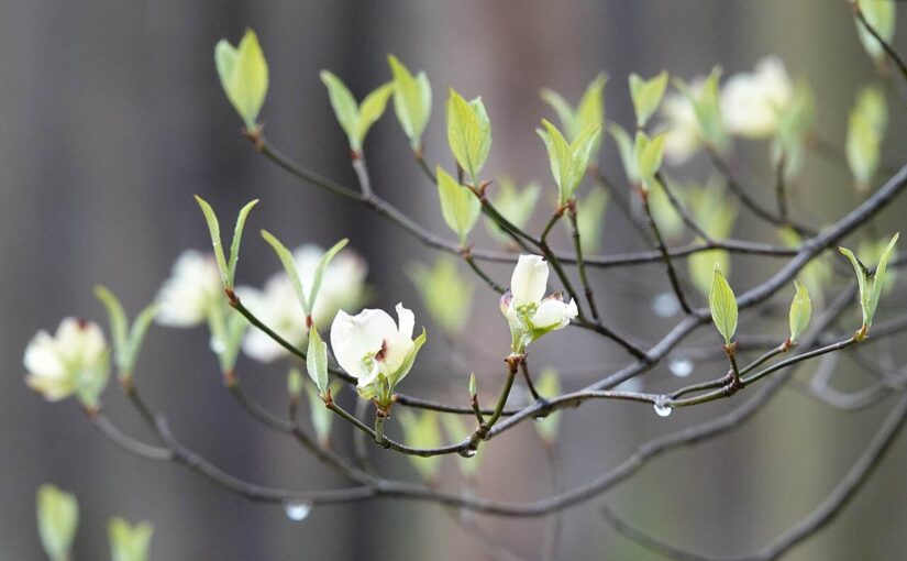
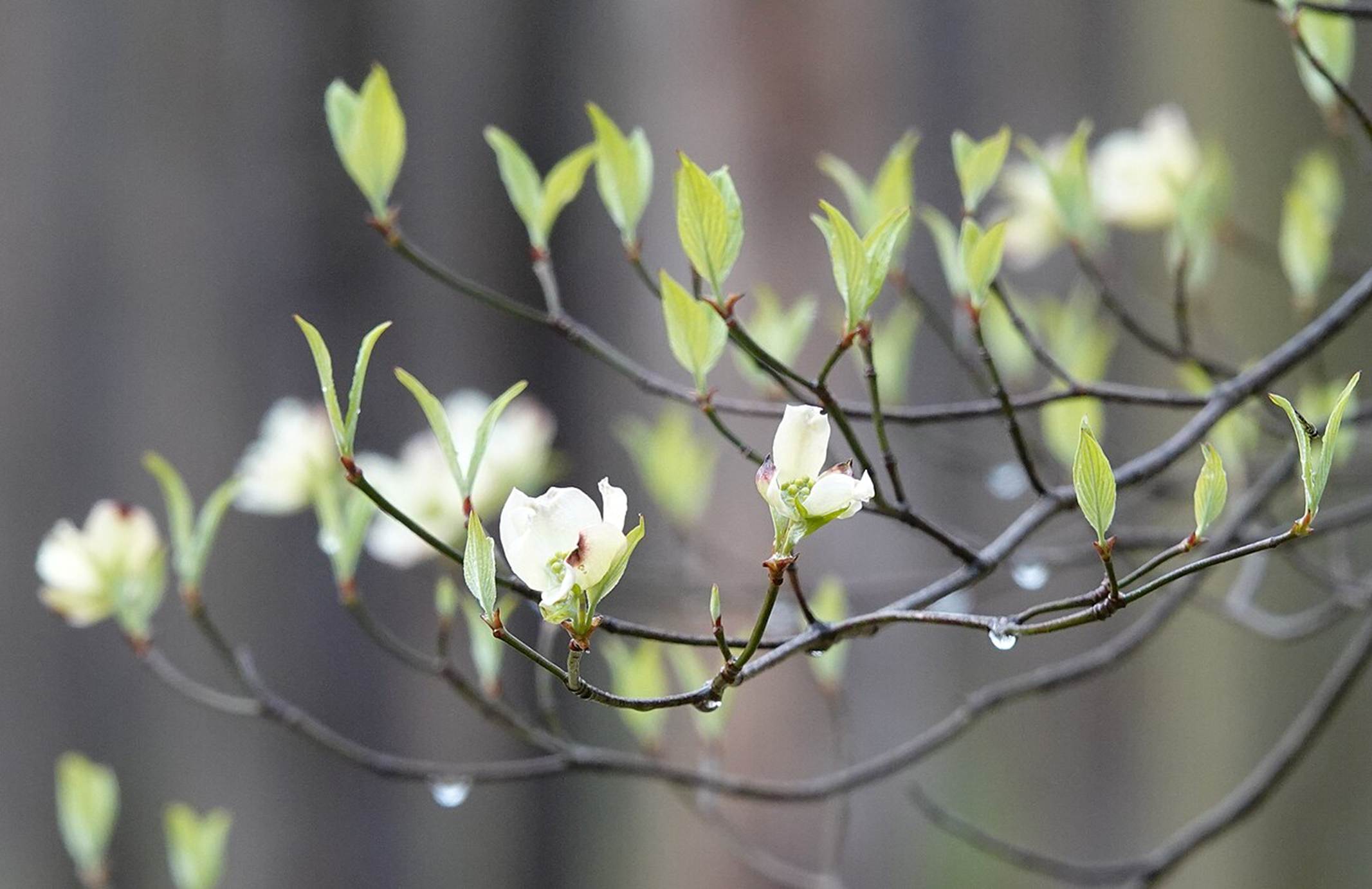
In the last month, I have received many questions about media stories describing the potential for a “Super El Niño” as well as questions about the drought that has plagued many parts of the United States this spring. They have both been getting a lot of attention in social media as well as the mainstream press and you have likely seen stories about them. In this post I will describe both phenomena and how they may affect gardeners in different parts of the country.
What is a “Super El Niño?”
In this blog we have discussed the impacts of both El Niño and its opposite, La Niña, many times, because this phenomenon, collectively called the El Niño Southern Oscillation (ENSO) has such a strong influence on the climate of not only the USA but also many other parts of the world. In the past few years of this blog, we have discussed the impacts of ENSO on seasonal temperature and precipitation in terms of their impact on the weather and climate you as gardeners are likely to have to deal with. You can search for these stories using the Search function on our home page.
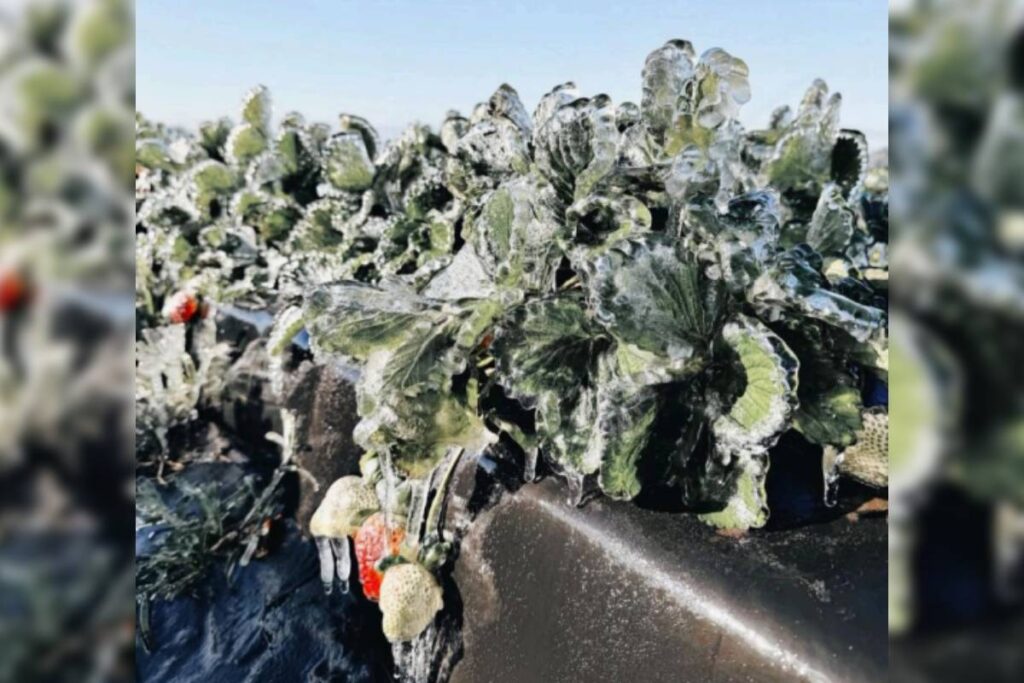
In this past winter, the US was under the influence of a weak La Niña, which led to warmer and drier conditions on average in the southern US and colder and wetter conditions in the northern US as the jet stream which directs the movement of precipitation-producing storms was shifted to the north due to the impacts of the unusually cold water in the Eastern Pacific Ocean (EPO). Note that these average conditions occurred even though there were several devastating cold outbreaks during the winter that resulted in freeze damage to fields and gardens as far south as central Florida that inflicted at least $3.17 billion in losses to the state’s agricultural industry.
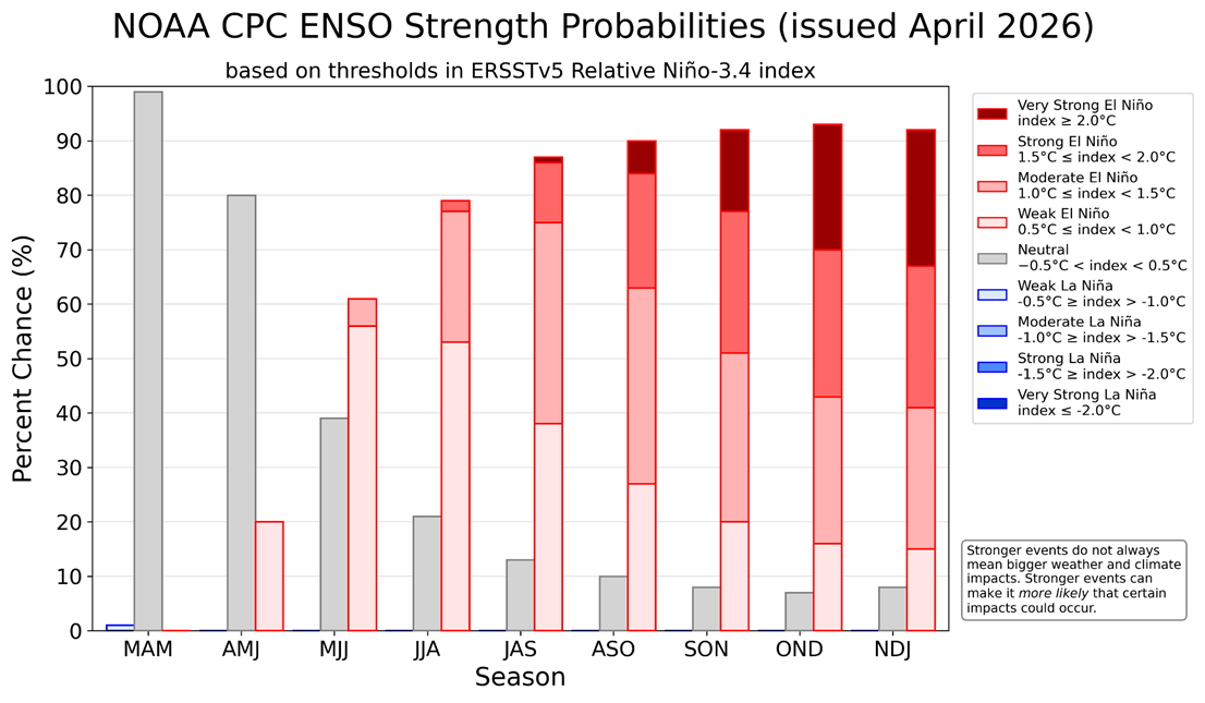
Earlier this month, the La Niña was declared officially ended, and we returned to neutral conditions where neither phase of the ENSO is occurring. But the predictions of ENSO indicate a swing to El Niño, the opposite phase, is soon to come, and that will affect our climate in the coming year. In fact, some forecasts indicate that this could be one of the strongest El Niños on record, with EPO temperature anomalies that exceed 2 degrees F, much higher than usual. Anything over 2 degrees F is considered a very strong El Niño, and this has been called a “Super El Niño” by some media outlets, although it really just means an unusually strong one with very warm ocean temperatures in the EPO. This does not happen very often, but the winters of 2023-2024 and 2015-2016 were also considered strong El Niños, so if you were gardening then, you might be able to remember what conditions were like when those events occurred.
What would be the impacts of a very strong El Niño?
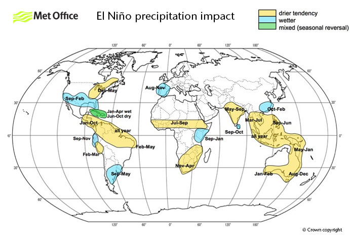
A sea surface temperature anomaly that high is likely to result in very strong El Niño impacts on the US and the world next winter which could start occurring as soon as late summer if it develops as fast as the predictions indicate. That would mean in North America that the winter in northern states and Canada could be relatively warm and dry (the opposite of last winter) and the climate conditions in the southern US could be wet and cool due to a lot of cloud cover from the rainy conditions. Whether or not a Super El Niño occurs is still very speculative, with the Climate Prediction Center saying that it is only about 25% likely that we will see a very strong El Niño. But even if it is a moderate or strong El Niño, we are likely to see winter climate conditions later this year consistent with El Nino patterns that we have seen in the past.
Over 50% of the Contiguous 48 States is now in drought
Meanwhile, over half of the US is currently experiencing some level of drought, and over 2/3 of the Lower 48 is experiencing some level of dry conditions. Interestingly, this can be linked in part to the La Niña we had last winter, since many of the areas in the worst drought received only meager rainfall this past winter due to the La Nina pattern. This was made worse by one of the least active Atlantic tropical seasons in recent memory, with only one named storm (Chantelle) making landfall in the Carolinas in 2025. The last time no hurricanes made landfall in the US was 2015. The extreme drought in the Southeast can certainly be linked to the lack of tropical rainfall, since 10-30 percent of our summer rain comes from tropical systems, even if they are not strong enough to be named. But the lack of precipitation over the winter of 2025-2026 due to La Niña was also a factor in the development of drought in both the Southeast and the West this spring.
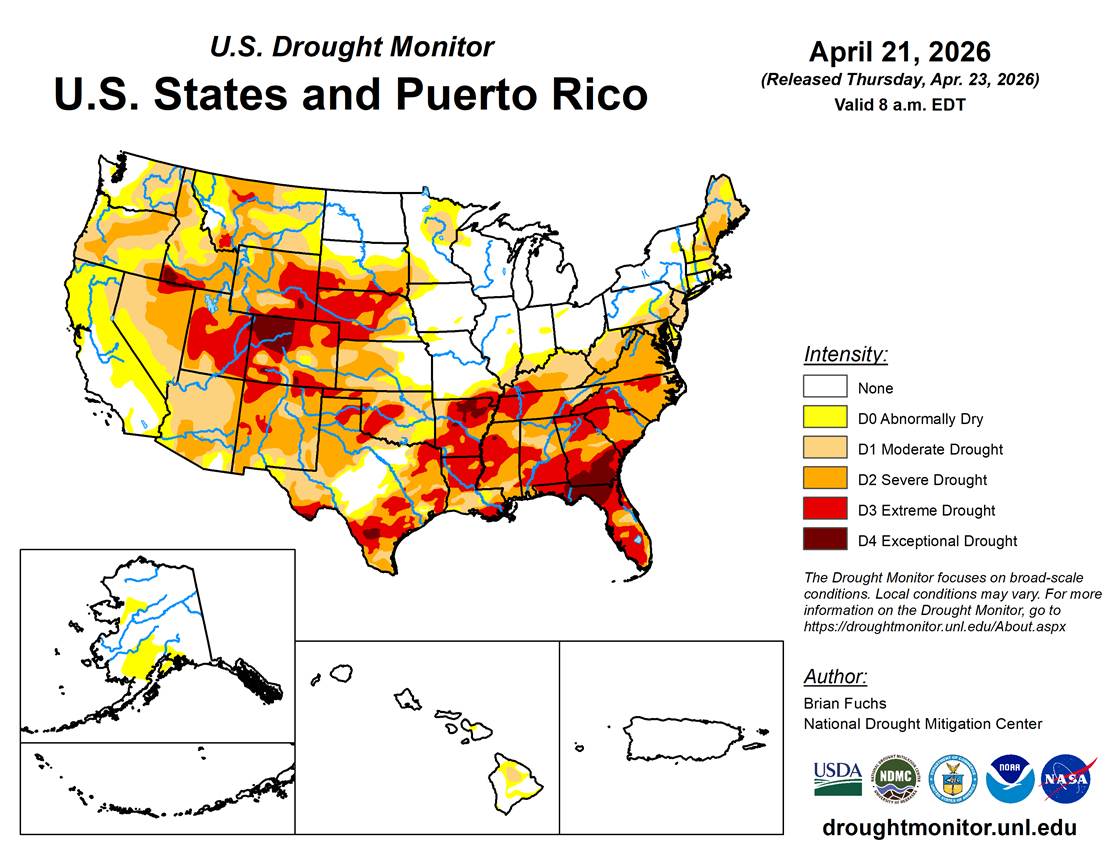
Normally, winter rain and snow recharge the soil moisture across the country in winter when most plants are dormant and temperatures and evaporation are low. But that did not happen this year for many parts of the country, leading to the development of drought. This only increased once plants came out of dormancy and started growing, pulling whatever water they could find from the ground. The only places with a big surplus of water are parts of the Midwest and Great Lakes regions, which have been hit by multiple heavy rain events this spring.
How long will this drought last?
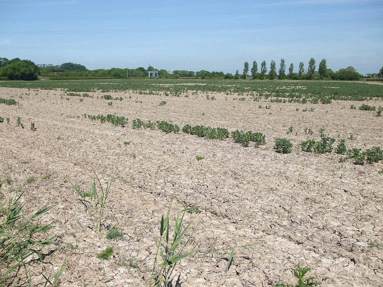
The most effective way to end a drought is either through a prolonged period of rain or by a tropical system that moves through the area. Since we are a few months from the Atlantic tropical season, we don’t expect any relief from that quarter any time soon. The high pressure that has been parked over the Southeast this spring has kept any significant fronts from moving through that region, leading to significant rainfall deficits of 50-70 percent over the last eight months. It will take months of wetter than normal conditions to make up for that lack of rain. Fortunately, this week the high pressure has moved east, allowing more rainfall into the dry regions of the Southeast, but it is a critical time for farmers and gardeners since they should be planting now but the ground is too hard and dry for that to occur and for seeds to germinate unless irrigation is provided. Some farmers are switching to different crops (for example, from corn to soybeans) to make sure they can ripen before the first fall frost occurs.
What does this mean for gardeners?
Fortunately, most gardeners can water their gardens unless severe water restrictions are in place, and in some states, watering food gardens is exempt from water restrictions. Make sure you know your local regulations and follow them. For those of you who are in areas with significant drought, you can expect to have to water more often or more deeply to make sure it reaches all the roots. Don’t forget to water bushes and trees as well, since they will also suffer from the drought. You can also plant drought-tolerant plants in areas where recurring drought is more likely. Of course, if you live in an area where there is too much rain, you will probably not need to water much for a long time until precipitation levels fall closer to normal, although the surface soil may dry out, increasing watering needs in hot weather.
If you live in areas affected by tropical weather, you can expect that there will not be many storms this year due to the El Niño. But keep watching the forecasts because if one does occur and makes landfall, it could affect you even in a year with fewer storms. It only takes one! Hurricane Andrew in August 1992 was in an El Niño summer and it did tremendous damage in both southern Florida and in Louisiana. Later in the summer, rain from the developing El Niño should relieve any drought conditions that are still occurring in the Southeast, although the western drought may still be occurring. Next winter is likely to be warmer and drier in northern states and wetter and cooler than normal in southern states due to the strong El Niño that is likely to be present, even if it is not a “Super El Niño.”
This post is a great reminder that we can’t just rely on simple “El Niño = wetter” assumptions, especially when it comes to planning and managing our gardens during extreme weather and drought across the US. It really helped me think more carefully about how climate patterns actually translate to conditions on the ground, rather than just headlines.
For gardeners trying to adapt to hotter, drier seasons, I’ve found that rethinking garden bed layout and plant spacing can make a big difference in how well soil holds moisture and how resilient plants are. There are some sample raised bed layouts that give practical ideas for arranging crops to cope better with stress and variable rainfall – could be a helpful next step for readers who are now re-evaluating their garden design in light of these climate trends.